Ana María Tárano
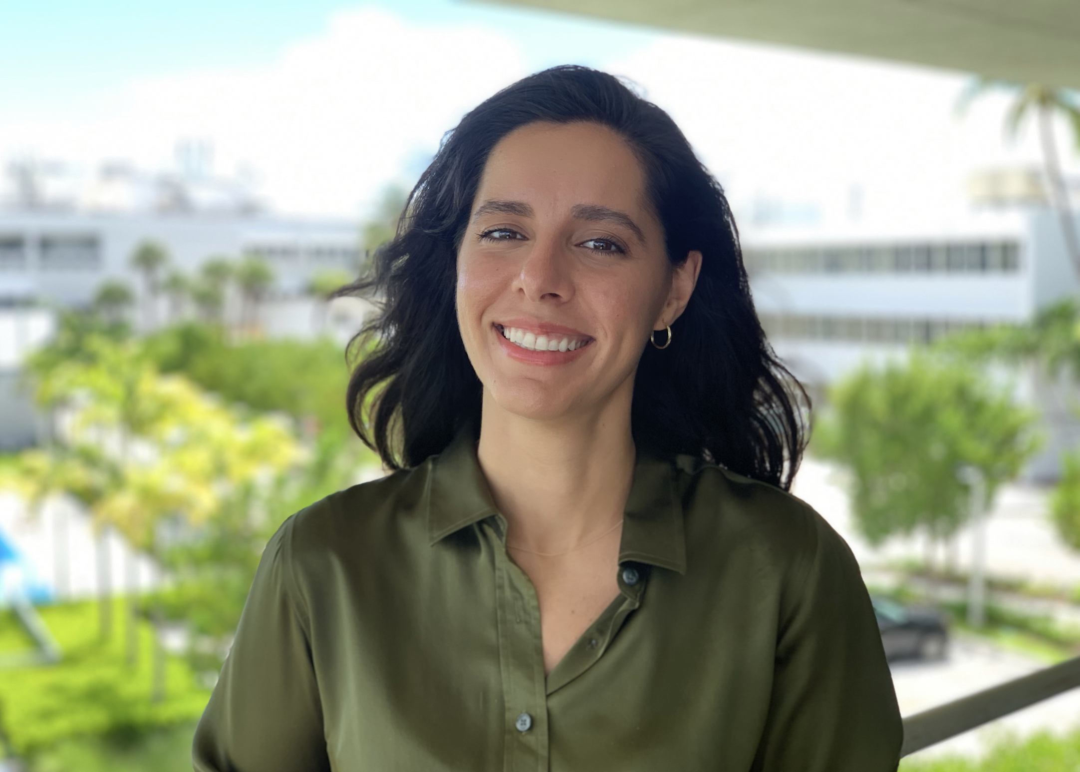
🗺️ I advance human-centered geospatial machine learning to support decision-making for food security and environmental resilience.
🤝 My research practice is emergent from a design thinking ethos.
HOME | BIO-SKETCH | RECENT PROJECTS | EDUCATION | PREVIOUS WORK | PUBLICATIONS | RECENT PRESENTATIONS | AWARDS
⏳ Bio-Sketch
Dr. Ana M. Tárano is an Assistant Research Professor at Arizona State University (ASU), conducting research on geospatial Machine Learning (geoML) for food security applications. Before joining ASU, Tárano was a Senior Research Associate III at the University of Miami (UM), where she applied geoML for shallow-marine habitat mapping using remotely sensed multispectral imagery. She also extended the NASA Planetary ReaCH public engagement model with art and the design thinking framework as a 2022 NASA SCoPE Seed Grant Awardee. Before her time at UM, Tárano implemented principles of design thinking while applying machine learning in a unique public-facing, real-time context as Project Manager for a conversational Artificial Intelligence (AI) installation led by interdisciplinary artist Rashaad Newsome through the Stanford Institute for Human-Centered Artificial Intelligence.
Tárano received her Ph.D. in Aeronautics and Astronautics from Stanford University. Her Ph.D. research improved asteroid modeling using physics-based simulations, statistical analysis, optimization, and machine learning. This work was funded by NASA’s Asteroid Threat Assessment Project (ATAP) at NASA’s Advanced Supercomputing Division. Her contributions to NASA’s ATAP were recognized by NASA’s Group Achievement Award and NASA Ames Honor Award. Her extensive aerospace engineering experience ranges from leading Stanford’s CubeSat QB50 Discovery to studying space radiation effects on astronauts at NASA Space Radiation Lab.
📰 Recent Projects
Humanitarian Food Security
Promptable GeoAI for Food Security in Conflict Zones
Funded by the Taylor Geospatial GIFS Challenge, we are developing open-source AI tools that allow humanitarian organizations to query satellite imagery in plain language to identify early warning signs of food insecurity in conflict-affected regions. Partners include the University of Maryland, Washington University in St. Louis, NASA Harvest, NASA Goddard, and FEWS NET. Test regions include Sudan, Ukraine, Syria, and Haiti.
📰 Devex: How geospatial AI is helping aid groups predict famine and deliver food
Other Updates
📄 NASA Lifelines Humanitarian Decision-Making for Food Security (Report)
Trazo: Field Boundary Detection in South America
🗺️ Trazo: Tracing fields, tracing commodities
An open-source AI framework in partnership with WRI for automatically delineating agricultural field boundaries from satellite imagery across South America. The first release maps nearly 11 million field boundaries across 17 soy-producing ecoregions, supporting supply chain traceability and deforestation monitoring.
📄 Field Boundaries of South America: WRI Technical Note
🌾 Blog Post: Why Accurately Mapping Crop Field Boundaries is Essential for Sustainable Supply Chains
Maui Nui Crop Monitor
The Maui Nui Crop Monitor is a collaborative effort that translates satellite observations into practical information for farmers, ranchers, natural resource managers, and community partners across Maui County. Originally developed to monitor agricultural conditions, the project has expanded to support wildfire recovery, drought monitoring, and disaster response following extreme weather events.
By combining Earth observation data with local knowledge, we provide timely geospatial products that help communities understand changing landscape conditions and make informed management decisions.
🌟 Recent Highlights
🌿 Vegetation Condition Index (VCI) App
The VCI app provides monthly maps of vegetation health, precipitation anomalies, and streamflow conditions across Maui County within a historical context. The app helps farmers, ranchers, and land managers monitor drought impacts, track ecosystem recovery, and make informed decisions that support resilient landscapes and watershed stewardship.
🌊 Kona Low Flood Mapping
Following the 2026 Kona Low storms, we developed rapid satellite-based flood extent maps and an interactive web application to document flood impacts across Maui County. Beyond emergency response, these tools help communities identify where landscapes failed to absorb water and where restoration, revegetation, and green infrastructure can better slow and infiltrate runoff in future events. Visit our Kona Lows Support page to explore the flood maps, resource hub, and satellite-derived products.
📰 Learn More
- 📧 Maui Nui Crop Monitor Email Archive — Monthly newsletters featuring drought updates, satellite-derived products, and community resources.
- 📰 ASU Engineering: Harvesting Satellite Insights for Maui County Farmers — Learn more about the Maui Nui Crop Monitor and how Earth observations are supporting agricultural resilience across Maui County.
Environmental Data Science Innovation and Inclusion Lab: Data Short Course 2024 🔗
April - June 2024
This year’s short course was called: Cloud Computing, Collaboration, and Communication. We learned how to incorporate GitHub (GitHub Classroom, GitHub Codespaces, and GitHub Pages) and Python (pandas, GeoPandas, rioxarray, matplotlib, folium) into our curriculum and existing research model. We applied these lessons to our own research interests and our educational programs. See what I worked on below.
Catalyst Miami: Community Leadership on the Environment, Advocacy, and Resilience 🔗
February - April 2024
This 10-week program provided us with the groundwork to become climate justice educators, leaders, and innovators in our own communities and beyond. We developed a deep and intersectional understanding of climate science, local climate change threats, and solutions. At the end of this leadership program, we worked in teams to propose our own community resilience project. See what I worked on below.
Reimagining Bus Stops as Resilience Hubs in Miami:
🎓 Education
Ph.D. in Aeronautics and Astronautics, 2020, Stanford University
M.S. in Aeronautics and Astronautics, 2015, Stanford University
B.S. in Aeronautics and Astronautics, 2014, Stanford University
💼 Work Experience
- Assistant Research Professor, Arizona State University, 07/2024–present
- Senior Research Associate III, University of Miami, 06/2022-01/2024
- Project Manager, Stanford University’s Institute for Human-Centered Artificial Intelligence, 11/2021-06/2022
- Research Associate, Science and Technology Corporation at NASA Ames, 06/2016-08/2020
- Course Assistant for Spacecraft Design and Laboratory, Stanford University, 03/2016-06/2016
📢 Publications
- Robinson, C., Muhawenayo, G., Khanal, S., Fang, Z., Corley, I., Tárano, A.M., et al. (2026). The first global agricultural field boundary map at 10m resolution. arXiv preprint arXiv:2605.11055.
- Cui, C., Jackson, R., Herrera, B.J., Tárano, A.M., & Kerner, H. (2026). Multi-Head LatentMoE and Head Parallel: Communication-Efficient and Deterministic MoE Parallelism. arXiv preprint arXiv:2602.04870.
- Grupp, T., Elmustafa, A., Zvonkov, I., Tárano, A. M., Jupiter, J., Esipova, E., Blevins, H., Nguyen, C., Tenorio Fenton, S., Winchester, C., Stolle, F., Rognstad, R., & Kerner, H. (2026). Field Boundaries of South America. World Resources Institute Technical Note. https://doi.org/10.46830/writn.25.00033
- Muhawenayo G, Robinson C, Khanal S, Fang Z, Corley I, Wollam A, Gao T, Strnad L, Avery R, Estes L, Tárano AM, Jacobs N, Kerner H. 2026. PRUE: A Practical Recipe for Field Boundary Segmentation at Scale. In: IEEE/CVF Conference on Computer Vision and Pattern Recognition (CVPR). https://arxiv.org/pdf/2603.27101
- Chausse, Rebecca, Daniel Andersen, Caitlin N. Howarth, Olivia Mooney, Danielle N. Poole, Nathaniel A. Raymond, Hannah Kerner, Ana María Tárano, Inbal Becker-Reshef. “The Impact of Systematic Razing of Agricultural Communities around El-Fasher: A Remote Sensing Study.” 10 March 2026, Humanitarian Research Lab at Yale School of Public Health: New Haven. Available at https://medicine.yale.edu/lab/khoshnood/publications/reports.
- Nakalembe, C., Zvonkov, I., Kerner, H. et al. Helmets Labeling Crops: Kenya Crop Type Dataset Created via Helmet-Mounted Cameras and Deep Learning. Sci Data 12, 1496 (2025). https://doi.org/10.1038/s41597-025-05762-7.
- Bakker, A. C., Gleason, A., Dempsey, A., Bachman, S., Burdick, D., Tárano, A. M., Chirayath, V., Purkis, S. (2024). Remotely Sensed Spectral Variability Predicts Reef Fish Diversity. Ecological Indicators, 169, 112823.
- Interactive AI “Performance”: Newsome, R. (Lead Artist), Symons, J. (Producer), & Tárano, A.M. (Project Manager). (2024, January). Being (The Digital Griot). Sundance Film Festival’s New Frontier section. Park City; Utah.
- Interactive AI “Performance”: Newsome, R. (Lead Artist), Symons, J. (Documentary Producer), & Tárano, A.M. (Project Manager). (2022, February-March). Being (The Digital Griot). Assembly at Park Avenue Armory. New York; New York.
- Tárano, A. M. (2020). Automated Inference of Impacting Asteroids’ Physical Properties and Motion. Stanford University.
- Tárano, A. M., Wheeler, L. F., Close, S., & Mathias, D. L. (2019). Inference of meteoroid characteristics using a genetic algorithm. Icarus, 329, 270-281.
- Aftosmis, M. J., Mathias, D. L., & Tárano, A. M. (2019). Simulation-based height of burst map for asteroid airburst damage prediction. Acta Astronautica, 156, 278-283.
🎤 Recent Presentations
- Tárano, A.M., Hess-Dunlop, A., Hodges, S.C., van der Lee, N., Nelson, L., et al. (2025). User-Centered Earth Observation and AI Tools for Agricultural Resilience in Maui County. Presented at American Geophysical Union Fall Meeting, 15-19 Dec. 2025 New Orleans, LA.
- Tárano, A.M., Tseng, G., Zvonkov, I., Nakalembe, C.L., Elmustafa, A., Grupp, T., et al. (2025). (Invited) Deploying GeoAI Systems in Real-World Agricultural Applications. Presented at American Geophysical Union Fall Meeting, 15-19 Dec. 2025 New Orleans, LA.
- Tárano, A.M., Tappan, G., Blevins, H., Nguyen, C., Smith, I., Pasztor, B., et al. (2025). Evaluating Conflict Effects in Sudanese Agriculture. Presented at American Geophysical Union Fall Meeting, 15-19 Dec. 2025 New Orleans, LA.
- Tárano, A.M., Tseng, G., Zvonkov, I., Janapaty, V., Hodges, S.C., Winfrey, N., et al. (2024). Strengthening Food Security in Maui County: Integrating Earth Observations, Machine Learning, and Local Knowledge. Presented at American Geophysical Union Fall Meeting, 9-13 Dec. 2024 Washington, D.C.
- Tárano, A.M., King, J., Buxner, S., LeMer, J., Rivera-Valentin, E.G., Rojas, C., et al. (2024). Assessing the Impact of Introducing Design Thinking and the Arts to the NASA Planetary ReaCH Public Engagement Model. Presented at American Geophysical Union Fall Meeting, 9-13 Dec. 2024 Washington, D.C. <!– * Becker-Reshef, I., Mitkish, M., Justice, C.O., Rhee, P., Skakun, S., Kerner, H.R., et al. (2024). Rapid Agricultural Assessments in Support of Agricultural Policy and Food Security. Presented at American Geophysical Union Fall Meeting, 9-13 Dec. 2024 Washington, D.C.
- Buxner, S., Shaner, A.J., LeMer, J., Rivera-Valentin, E.G., Lynch, K., Shupla, C.B., et al. (2024). Supporting Planetary Scientists to Engage with Black and Latinx Youth and Families. Presented at American Geophysical Union Fall Meeting, 9-13 Dec. 2024 Washington, D.C.
- Rojas, C., King, J., Shaner, A.J., Shupla, C.B., and Tárano, A.M. (2024). CERES Deployed on Earth: A Planetary Science Engagement Planning Model. Presented at American Geophysical Union Fall Meeting, 9-13 Dec. 2024 Washington, D.C.
- King, J., Buxner, S., Tárano, A.M., Shaner, A.J., Rojas, C., and Shupla, C.B. (2024). Using Focus Group Data for Improvement-Can Machine Learning Help?. Presented at American Geophysical Union Fall Meeting, 9-13 Dec. 2024 Washington, D.C.
- Shaner, A.J., Buxner, S., King, J., Kriescher, D., LeMer, J., Lynch, K., et al. (2024). What does a Culturally Inclusive Planetary Engagement workshop look like?. Presented at American Geophysical Union Fall Meeting, 9-13 Dec. 2024 Washington, D.C.
- Muhawenayo, G., Zvonkov, I., Nakalembe, C.L., Tárano, A.M., Smith, I., et al. (2024). Quantifying the Impact of Conflict on Agricultural Land in Sudan Using Machine Learning and Earth Observation Data. Presented at American Geophysical Union Fall Meeting, 9-13 Dec. 2024 Washington, D.C. –>
- Tárano, A.M., Chirayath, V., Purkis, S., Xi, H. and Bakker, A. (2023). Evaluating Global Benthic Habitat Maps Derived from Machine Learning: NASA’s Neural Multimodal Observation and Training Network. Presented at American Geophysical Union Fall Meeting, 11-15 Dec. 2023 San Francisco, CA.
- Tárano, A.M., Shaner, A.J., Shupla, C.B., Buxner, S., Rivera-Valentin, E.G., LeMer, J., King, J., Kriescher, D., and Valdes, Y. (2023). Extending the Planetary ReaCH Towards Miami with SCoPE: Embracing Local Assets for Informal Education of NASA-based Planetary Science. Presented at American Geophysical Union Fall Meeting, 11-15 Dec. 2023 San Francisco, CA.
- Tárano, A.M., Chirayath, V., Couch, C., Oliver, T., and Purkis, S. (2023). Informing coral reef resilience-based management through prediction of individual coral organismal growth, recruitment, and mortality (PICOGRAM). Presented at NASA Biodiversity and Ecological Forecasting Team Meeting, 8-9 May 2023 College Park, MD.
- Tárano, A.M., Chirayath, V., Segal-Rozenhaimer, M., and Purkis, S. (2022). Toward Global Coral Resilience and Biodiversity Assessments Using NASA NeMO-Net and Fluid Lensing. Presented at American Geophysical Union Fall Meeting, 12-16 Dec. 2022 Chicago, IL.
- Tárano, A.M., Chirayath, V., Couch, C., and Oliver, T. (2022). Informing coral reef resilience-based management through prediction of individual coral organismal growth, recruitment, and mortality (PICOGRAM). Presented at NASA Biodiversity and Ecological Forecasting Team Meeting, 20-22 Sept. 2022 College Park, MD.
🏆 Awards
- NASA Group Achievement Award, 2023, “in appreciation of [NASA Science Activation program] dedicated service to NASA from the Science Mission Directorate.”
- AGU NASA SciAct Affiliate, 2023, from NASA SMD Community of Practice for Education.
- Early Career Researcher Grant, 2023, from University of Miami Institute for Data Science and Computing.
- Seed Grant Award, 2022, for project “Extending the Planetary ReaCH Towards Miami” by NASA SMD Community of Practice for Education.
- Engineer of the Future Leadership Award, 2020, from Straubel Foundation “to support high-achieving individuals in their pursuit of education”.
- ASSU Champion Advocate Award, 2019, from Associated Students of Stanford University (ASSU) “for [my] advocacy for overlooked communities and uplifting voices of others”.
- Community Impact Award, 2019, from Stanford Alumni Association for having “fostered a sense of belonging and inspired enthusiasm among fellow grad students, enhancing the Stanford community through their exemplary leadership of a student organization, creation of an event or program, or other unique campus contribution”.
- NASA Group Achievement Award, 2018, for Asteroid Threat Assessment Project “for advancing state-of-the-art in asteroid threat assessment to enable effective national survey and response planning”.
- NASA Ames Honor Award, 2017, for “contributions to the Near-Earth Objects (NEO) impact risk assessment team”.
- Outstanding Poster Award, 2017, for Stanford University Opportunity Job Fair.
- Sharon Kay Stanaway Summer Doctoral Fellowship, 2016, from Stanford University’s Aeronautics and Astronautics Department.
- Enhancing Diversity in Graduate Education Doctoral Fellowship, 2016-2020, from Stanford University.
- Dean’s Packard Diversity Fellowship, 2014-2015, from Stanford University’s School of Engineering.